


In showing people screenshots of my game project, it’s sometimes difficult to get across a sense of scale. Below is a visual update to show the scale differences between the game’s three main zoom levels. The top one is zoomed out to orbit, the second is the level at which you’ll send scout ships on survey missions around the area to push back a “fog of war” style map and uncover resources etc. The third is the level at which you’ll manage the colony. The camera angle is different there just because buildings will look better with it.
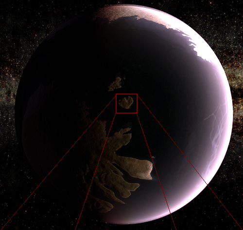
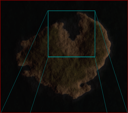
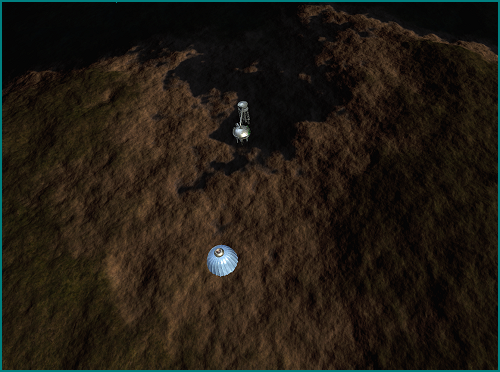
So the area visible at the closest zoom level is about 10×10 pixels from orbit. The extra detail is added procedurally as you zoom in. Hopefully that helps give some sense of scale. For reference, the buildings in the bottom image are gargantuan things. Colony buildings will probably be this size but presented as massive industrial complexes etc. Then comparitively tiny houses will be procedurally added as the population increases, with tiny roads sprawling out from the colony site and houses appearing along them. This should help maintain the sense of scale I’m looking for, but I’ll have to see it in action to be sure.